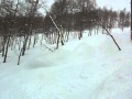
Powder Predictor
Spring is sprung with wet weather in Vail, Aspen
Aspen/Snowmass, central mountains in the crosshairs
First day of spring and a strong low sits in the southwest, eyeing the Rocky Mountains. Strong winds will welcome afternoon commuters in both the Vail and Roaring Fork Valleys.
Red flag warnings are posted for much of the Front Range as 60 mph winds are expected in the "City." Mountain valleys can expect winds in the 25-mph range with ridge-top gusts in the 50-60 mph range.
Temps remain warm for today, as this low creeps northward, bringing good moisture and jet stream dynamics.
Tuesday, March 22, looks to be colder and quite windy as we see an associated cold front with the low. On-mountain highs in the low 20's and still gusty southwest winds in the 20-mph range are expected.
Snowfall totals for overnight tonight into Tuesday look light. Morning reports in the 3-5 inch range for Vail/Beaver Creek and 5-10 inches for Aspen/Snowmass. Don't be surprised if you see the dreaded dust layer Tuesday morning as these southwest winds will surely move the desert sands our way.
The central mountains, including Aspen/Snowmass, Crested Butte, and Monarch, could be in for a huge day if temps can drop quickly enough this afternoon and tonight. Hard to say how cold it will become with the origin of this storm. However, up to 12 inches could happen overnight tonight if events work out correctly.
Still an active pattern for the first week of spring, and all we need is just a few storms to really freshen up the mountain slopes. March madness may very well happen on mountain, as I'm sure most of the brackets out there have been busted.
Enjoy!
![]() 0 Comments on "Spring is sprung with wet weather in Vail, Aspen"
0 Comments on "Spring is sprung with wet weather in Vail, Aspen"
Be the first to comment below.
 Vail Town Council to weigh new plan to redevelop T...
  All about indexes
  Transforming your social security into a winning r...
  Pass sales, real estate transactions, revenues inc...
  Vail Valley native with passion for Biophilic inte...
  Land Trust, ECO Trails, Vail Resorts team up to cl...
  EUROVISION named Host Broadcaster for 2015 World A...
  Vail Resorts brings back Lindsey Vonn's 'School of...
  Hundreds turn out for 2015 World Championships vol...
  Eagle County Senior Health Expo and 9th Annual Hea...
 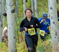 Final race of Vail Mountain Trail Running Series s...
  Before you write your will ...
  2015 World Ski Championships volunteer recruitment...
  Ascent Sotheby’s International Realty in Vail an...
  CDOT outlines road closures for local stages of US...
  Italian artist creates unique trophies for Vail, B...
  Vail Recreation District once again hosting Jake W...